The Role of Ocean Currents in Climate

Resource for Grades 6-12

The Role of Ocean Currents in Climate

Media Type:
Video

Running Time: 3m 48s
Size: 11.3 MB

or


Source: ThinkTV


Resource Produced by:

ThinkTV

Collection Developed by:

ThinkTV

Collection Credits

Collection Funded by:

Corporation for Public Broadcasting

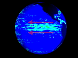
Ocean surface currents have a major impact on regional climate around the world, bringing coastal fog to San Francisco and comfortable temperatures to the British Isles. This video segment produced by ThinkTV uses data-based visual representations adapted from NOAA to trace the path of surface ocean currents around the globe and explore their role in creating climate zones.

open Background Essay

Ocean currents are a vital piece of the puzzle that explains how the global climate system works. Without them, there would be no way for Earth's oceans to distribute their incredibly large supplies of heat energy around the world, warming climates in some regions while cooling them in others.

In the oceans, a current refers to the motion of water. There are different kinds of currents moving in paths in different parts of the world. Tidal currents move with the motion of high and low tides, flooding toward land and then ebbing away in response to the gravitational pull of the Moon. Coastal currents, such as the California Current described in the video, move in response to dominant, prevailing local winds. Open-ocean surface currents, meanwhile, are currents put in motion by global wind patterns, such as the tropical and sub-tropical winds that blow from the east (trade winds) or the west-to-east-flowing winds at mid-latitudes (the westerlies).

Surface ocean currents are also driven by an effect caused by Earth's rotation on its axis known as the Coriolis effect. The rotation of Earth acts to turn or deflect prevailing winds clockwise in the Northern Hemisphere and counterclockwise in the Southern Hemisphere, which deflects the surface currents.

When the winds that drive surface currents strengthen or weaken, they can cause profound changes in surface ocean currents. This is the case with the phenomenon known as El Niño, in which currents off the coast of South America slow down in response to a weakening of the easterly trade winds.

In addition to surface ocean currents, there are also currents deep below the surface. Sub surface currents flow thousands of meters below the surface, and are driven by another mechanism: changes in the density of ocean water as it travels between the warm equator and the chilly polar regions of Earth. Warm water, as it nears the poles, becomes cooler and denser and sinks. The water, now a sub surface current, moves in predictable patterns throughout the deep ocean, slowly mixing with less dense water.

Energy transfer is an essential function played by ocean currents. By transferring heat energy around the globe, ocean currents shape both local weather conditions and global climate. For example, warm ocean currents create the conditions that spawn tropical cyclones and hurricanes—local severe weather conditions. On a larger scale, warm ocean currents such as the Gulf Stream warm entire continents, and help create and sustain global climate conditions.


open Teaching Tips

Here are suggested ways to engage students with this video and with activities related to this topic..

  • Beginning a lesson: Provide students with two world maps, one labeled "before" and the other "after". Have students predict ocean temperatures and currents on the “before” map prior to watching the video segment. Students will revisit the "after" map after watching the segment, drawing in currents and ocean temperatures. Students should compare predictions to knowledge obtained from the video segment.
  • Viewing the video: Use the following suggestions to guide students’ viewing of the video.
    • Before: Where is the ocean surface temperature the highest? [near the equator] Where is it the lowest? [near the poles]
    • During: In which direction do ocean currents flow in the Northern Hemisphere? [clockwise] In the Southern Hemisphere? [Counter clockwise]
    • After: Why can we think of ocean surface currents as energy transportation mechanisms?
  • Doing research projects—groups: Can climate be predicted using ocean surface currents and latitude? Have each group of students research an assigned coastal city to determine what type of climate the city has. Students should use latitude as well as ocean surface currents to explain the climate of their assigned city. Students will report results back to the class to see that ocean currents and latitude both affect the climate of a city.
  • Taking a stand: With the large cutbacks made in the National Budget for research in the sciences, you must convince the Appropriations Committee of the Senate that your organization should be funded. Students will be divided into teams to represent either NASA (National Air and Space Administration) or NOAA (National Oceanic and Atmospheric Administration). Each team must research and then present their reasoning as to why their respective organization should be funded for research either in the area of space exploration or ocean systems including currents; only one group will be funded in the upcoming budget. The chair of the Appropriations Committee (the teacher) will have the final determination as to where to appropriate the research monies.

open Standards

 
to:

Loading Content Loading Standards

PBS LearningMedia
Teachers' Domain is moving to PBS LearningMedia on October 15, 2013. On that date you will be automatically redirected to PBS LearningMedia when visiting Teachers' Domain.
Close PBS LearningMedia PBS LearningMedia Login