Teachers' Domain - Digital Media for the Classroom and Professional Development
User: Preview

Source: ThinkTV
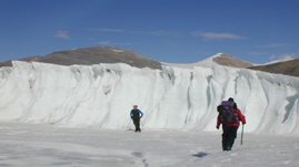
Glacial meltwater is a natural resource critical to the survival of people in many parts of the world. Understanding the complex relationships between changing climate, populations, and water requires years of field research. In this video produced by ThinkTV, see how researchers solve the problems of making water measurements in rugged mountain locations—one small part of the efforts of an international climate research team.
Alpine glaciers—moving rivers of ice in high mountain ranges in North America, South America, and elsewhere—are a wonder of nature. But they are much more than beautiful scenery: nearly one-sixth of the world's population depends upon glaciers as a source of fresh water for drinking, as well as for irrigating crops and making electricity. Scientists are now studying glaciers to understand the impact of climate change on ice volume and, ultimately, to determine if changes in ice accumulation will affect the availability of water for communities around the world.
In order to predict the impacts of warming temperatures on glaciers, scientists measure the rate at which glaciers are losing mass. This turns out to be a complicated process because the rate at which a glacier loses mass depends upon many factors, including average air temperatures, precipitation, and humidity. Researchers use a variety of sources of data to measure these variables, including aerial photography, satellite images, and field observations.
To measure the impact of glacial melting on local drinking water supplies, scientists carry out field studies to measure changes in the water supply of the region. In the video resource, an international team of scientists studies the movement, distribution, and quality of the water in a local watershed—its hydrology. The scientists must do much of the measurement themselves, since very little hydrologic information has been collected in these remote regions. Their primary interest is to create a model of the watershed that identifies the respective contributions of glacial meltwater and groundwater to streamflows during the dry season. They do this by looking for tracers, unique chemical signatures that can be used to identify the sources of the water in the stream. By taking water samples and measuring electrical conductivity, pH, and temperature, researchers develop a hydrologic model of the stream and the relative contributions of different sources of moisture throughout the year. As the video makes clear, scientists must be creative in making sturdy, low-cost tools from locally available materials to successfully make these measurements in rugged locations.
Understanding how local residents adapt to changing climate conditions requires a different kind of research. Anthropologists and human geographers work in these same Andes Mountains communities, talking to residents and learning about their lives and farming practices. By building cultural understanding and promoting communication, scientist teams and local communities build trust and respect as they try to solve critical issues related to the impacts of climate change.
Here are suggested ways to engage students with this video and with activities related to this topic.
 Loading Standards