
Geospatial Revolution: GIS Vocabulary
(Interactive)
 Download and Share
The history of maps began thousands of years ago, possibly even before the written word was invented. Mapmaking or cartography came into being to fulfill the purpose of plotting the topography of the land and transportation routes. The discovery of new lands or regions was usually accompanied with the creation of a map. Lewis and Clark’s expedition of 1804-1806, for instance, was the first to create an accurate representation of the land bought in the Louisiana Purchase. Maps were originally depicted on clay tablets during Babylonian times. Paper maps followed, but the production of hand-drawn, illuminated maps in medieval times was so labor intensive that few were distributed. Beginning in the 15th century, with the advent of printing presses, it was possible to distribute maps widely. Aerial mapping, starting in World War I, eventually gave way to electronic maps in the 60s as computers combined software, hardware and data into Geographic Information Systems (GIS).
GIS produces thematic maps with a lot more information than a traditional paper-based map can hold. The first GIS systems relied upon room-sized mainframe computers. A mainframe is a powerful computer that can analyze tremendous quantities of data. Canada’s Department of Forestry and Rural Development developed the world’s first operational GIS. It was called the Canada Geographic Information Systems (CGIS) and the developer, Dr. Roger Tomlinson, has come to be known as the ‘father of GIS’. The development of GIS took place through many disciplines at many universities and it was used for a variety of governmental purposes. For instance, Dr. Howard Fisher at Harvard developed a program called SYMAP, which later became the model for other programs. The U.S. Census Bureau developed DIME (Dual Independent Map Encoding) in the 1960s and TIGER (Topographically Integrated Geographic Encoding and Referencing) in the 1980s to gather data about the country’s population with reference to land. Although GIS was initially designed for specific applications and dependent on mainframe computers, by the end of the 20th century it was commercially available and was being used by community and neighborhood organizations.
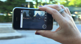
Today, GIS is available to millions of individual users and is being applied in banking, defense, education, archaeology and more. It is present in the commercially available GPS receivers and GIS technology in smartphones. Internet technologies and projects such as Google Maps, Google Earth and OpenStreetMaps also depend on GIS for generating maps. Businesses such as realtors find that they benefit from the use of this technology and so do organizations such as Ushahidi, which work to build maps using digital communication during crises. GIS is finding an ever-increasing number of applications and changing the way we see the world.
To learn more about the history of geography, check out a video resource that traces the origin of maps to clay tablets in Babylonian times Geospatial Revolution: History of Geography.
To learn more about political geography, check out a video resource about maps that revealed potential voters during the 2008 presidential campaign Geospatial Revolution: Political Aspects.
To learn more about why geography is important, check out a video resource that explains how GIS helps us to understand how the earth works, climate change, and what new occupations have been sparked by emerging geospatial technologies Geospatial Revolution: Importance of Geography.
To learn more about why you might want to study geography, check out a video resource that illustrates how maps can help you protect yourself and your house from an emergency, like raging wildfires Geospatial Revolution: Why Study GIS?.
To learn more about vocabulary that has developed with the growth of GIS, check out this interactive with relevant videos and embedded assessments of your understanding Geospatial Revolution: GIS Vocabulary.
To consider the expanded roles and responsibilities of citizens and government In the digital age, check out a video resources that profiles a city using technology, especially geospatial applications, in a variety of operations. Geospatial Revolution: Portland, an Interactive City.
To consider how GIS technology is helping address the lack of easy access to fresh food in high poverty neighborhoods, check out a video resource that profiles Philadelphia's use of geospatial applications. Geospatial Revolution: Food Deserts.
To consider how technology is rapidly changing the nature of jobs and careers in ways that will affect your opportunities, check out an interactive resource that profiles several job requirements at UPS. Geospatial Revolution: Your Next Job.
To learn more about how GIS is used to monitor areas of conflict, check out a video resource that shows how the US military uses GIS to protect soldiers in combat Geospatial Revolution: GIS to Monitor Areas of Conflict.
 Loading Standards


 Print Background Essay