
Geospatial Revolution: GIS Vocabulary
(Interactive)

Geospatial Revolution: Your Next Job
(Interactive)
National K -12 Subject:
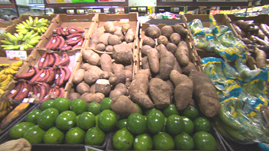
Food deserts is a term used to describe a region where the population has poor access to healthy, fresh, nutritious food. They exist in both rural and urban areas and are turning into a public health concern. GIS technology is supporting the solution to this problem by vividly identifying the problem area and influencing policy-making. This video segment from Penn State Public Broadcasting’s Geospatial Revolution describes one Philadelphia community’s successful efforts at doing the same.
 Download and Share
GIS technology has its roots in laying demographic data onto a terrain map and helping to visualize societal attributes. Today, it is used not only to map population census data, but also data about population behavior- including nutrition and lifestyle. In doing so, its value goes far beyond being a static information repository to a potentially life-changing tool. Lately it has helped bring the spotlight to food deserts in America.
Food deserts refer to areas that suffer not from a lack of food, but lack of easy access to healthy, fresh and nutritious food. They exist all over America in inner cities as well as in rural communities. Due to low profits, supermarkets often don’t exist in these neighborhoods. Detroit is a prominent example, with half the city’s population living in a food desert. Chicago and Philadelphia are similarly affected.
Technically, a neighborhood is in a food desert if the nearest supermarket offering fresh produce is more than a mile away and the majority of its population doesn’t have access to vehicles to visit the ones that exist. About 5.4% or 5.7 million households live within half a mile to more than a mile away from a supermarket. Although this is not a great distance, for a person in a low-income household with multiple jobs and responsibilities and no car, using public transportation to visit the supermarket can be daunting. Often, the more convenient option is a convenience and/or fast food store, which is just around the corner. The food there is cheaper and quicker, but also far less nutritious than fresh produce. Making this food a part of daily life can have devastating effects on the overall quality of life.
GIS helps in identifying these food deserts by overlaying maps depicting the presence of supermarkets and data about population, poverty and nutrition related diseases. States are using this data to develop multi-million dollar state and federal grants, which will help build supermarkets and farmer’s markets in several underserved parts of the country. In the video segment from Penn State Public Broadcasting’s Geospatial Revolution, we see the change being brought about in Philadelphia’s food deserts.
The information produced and made available by geospatial technologies helps to visualize social issues and potentially to make policy changes. In the present case, it has also helped kick-start an employment program, by creating supermarket and food related jobs. On the other hand, it is benefitting large corporations by supporting their development in previously unprofitable regions. Depending upon the community’s response, these supermarkets may put the convenience stores out of business or at least reduce their profits. Not only are GIS and political will changing what these communities eat, but also those who feed them.
To learn more about the history of geography, check out a video resource that traces the origin of maps to clay tablets in Babylonian times Geospatial Revolution: History of Geography.
To learn more about political geography, check out a video resource about maps that revealed potential voters during the 2008 presidential campaign Geospatial Revolution: Political Aspects.
To learn more about why geography is important, check out a video resource that explains how GIS helps us to understand how the earth works, climate change, and what new occupations have been sparked by emerging geospatial technologies Geospatial Revolution: Importance of Geography.
To learn more about why you might want to study geography, check out a video resource that illustrates how maps can help you protect yourself and your house from an emergency, like raging wildfires Geospatial Revolution: Why Study GIS?.
To learn more about vocabulary that has developed with the growth of GIS, check out this interactive with relevant videos and embedded assessments of your understanding Geospatial Revolution: GIS Vocabulary.
To consider the expanded roles and responsibilities of citizens and government In the digital age, check out a video resources that profiles a city using technology, especially geospatial applications, in a variety of operations. Geospatial Revolution: Portland, an Interactive City.
To consider how technology is rapidly changing the nature of jobs and careers in ways that will affect your opportunities, check out an interactive resource that profiles several job requirements at UPS. Geospatial Revolution: Your Next Job.
To learn more about the history of GIS, check out a video resource that traces the development of GIS from centuries of mapmaking to 21st century computer-based technology Geospatial Revolution: History of GIS.
To learn more about how GIS is used to monitor areas of conflict, check out a video resource that shows how the US military uses GIS to protect soldiers in combat Geospatial Revolution: GIS to Monitor Areas of Conflict.
 Loading Standards


 Print Background Essay