
Geospatial Revolution: Your Next Job
(Interactive)
Babylonian clay tablets of an ancient age carried maps and information in the form of pictures or cuneiform writing. This form existed for more than 30 centuries; letters and words evolved from these pictures during the Roman era. This was a very important development, because it offered a way to communicate a lot of information using fewer symbols, similar to the way GIS now offers a way to convey a lot of information through small electronic devices. Ever since that time in history, words have become a mainstay of every civilization - whether in the west or the east - and one of the chief ways of communicating information and ideas.
Words play a crucial role in understanding something unknown. In the case of a map, words are just as important as topographical images because a map is a representation and we need words to make sense of it. Imagine, e.g., a map of the U.S.A. that does not contain the names of its states, cities, rivers and deserts. For someone unfamiliar with the country’s geography, the map will be nothing more than a strange shape with strange marks on it! Mapmaking, aka cartography, has a set of words to help practitioners describe different techniques, landforms, the kind of map, etc. Latitude, longitude, key, magnetic north, names, distances and more are all part of a map - whether static or dynamic.
Today, GIS is developing into a discipline of its own. It is an interdisciplinary science rooted in geography, technology and physics at the very minimum, and may add other subject areas to this list depending upon the future direction it takes. Like every other science, it is developing a special vocabulary that helps researchers, practitioners and users discuss GIS and its applications. For instance, the acronym GIS stands for ‘Geographic Information System’ and it was created in order to describe this technology by bringing together pre-existing words in a meaningful sequence. ‘Geospatial’, on the other hand, is a word created to describe the software-based analysis of spatial, geographical data, and so are ‘geomatics’ and ‘geofence’. Understanding the meaning and usage of these words is an excellent way to understand the technology they support.
To learn more about the history of geography, check out a video resource that traces the origin of maps to clay tablets in Babylonian times Geospatial Revolution: History of Geography.
To learn more about political geography, check out a video resource about maps that revealed potential voters during the 2008 presidential campaign Geospatial Revolution: Political Aspects.
To learn more about why geography is important, check out a video resource that explains how GIS helps us to understand how the earth works, climate change, and what new occupations have been sparked by emerging geospatial technologies Geospatial Revolution: Importance of Geography.
To learn more about why you might want to study geography, check out a video resource that illustrates how maps can help you protect yourself and your house from an emergency, like raging wildfires Geospatial Revolution: Why Study GIS?.
To learn more about the history of GIS, check out a video resource that traces the development of GIS from centuries of mapmaking to 21st century computer-based technology Geospatial Revolution: History of GIS.
To consider the expanded roles and responsibilities of citizens and government In the digital age, check out a video resources that profiles a city using technology, especially geospatial applications, in a variety of operations. Geospatial Revolution: Portland, an Interactive City.
To consider how GIS technology is helping address the lack of easy access to fresh food in high poverty neighborhoods, check out a video resource that profiles Philadelphia's use of geospatial applications. Geospatial Revolution: Food Deserts.
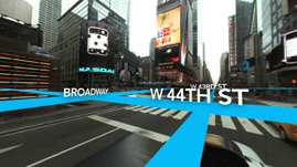
To consider how technology is rapidly changing the nature of jobs and careers in ways that will affect your opportunities, check out an interactive resource that profiles several job requirements at UPS. Geospatial Revolution: Your Next Job.
To learn more about how GIS is used to monitor areas of conflict, check out a video resource that shows how the US military uses GIS to protect soldiers in combat Geospatial Revolution: GIS to Monitor Areas of Conflict.
 Loading Standards


 Print Background Essay