Teachers' Domain - Digital Media for the Classroom and Professional Development
User: Preview


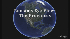
In this video, students take a virtual tour of five major provinces, or regions, of the Roman Empire during its height in the 1st century A.D.: Hispania, Gaul, Germania, Italy, and Greece. Students learn about the prominent geographical features of each province. Hispania, a peninsula, was the western-most province of the empire. Gaul was divided into two parts by a mountain range called the Alps. Greece is characterized by its many islands and the Isthmus of Corinth. Students consider how these geographical features affected life in those provinces.
A Roman’s-Eye View: The Provinces
The Roman Empire was populated by many different people from many different cultures. There were Italian Romans who lived in Italy but outside the city of Rome. There were Gallic Romans who wore trousers (much disdained by the urban population). There were “Hispanic” Romans—Romans from the province of Hispania. A survey of some of the major Roman provinces promotes an understanding of the complex multicultural nature of Rome and an appreciation of the geographical features that influenced the people who lived there.
The western-most province, Hispania, covers land roughly equivalent to modern Spain and Portugal. Republican Rome conquered it in the late 3rd century B.C. It’s location on the Iberian Peninsula offered control of Mediterranean and Atlantic waters. Its fertile southern region, called Baetica, supplied wine and olive oil to the rest of the empire and was also the birthplace of the emperor Trajan.
Northeast of Hispania, Gaul was split into two parts by the Alps north of Italy. Transalpine Gaul (“Gaul across the Alps”) was a large area roughly equivalent to modern France, Luxembourg, Belgium, and parts of the Netherlands and Germany. Cisalpine Gaul (“Gaul on this side of the Alps”) consisted of modern Switzerland and northern Italy. Gaul was conquered and Romanized early; Julius Caesar finished his conquest in 51 B.C.
East of Gaul was the province of Germania, consisting of only the west half of present-day Germany. Romans only ever had control of the area west of the Rhine River, failing to conquer the area east of the Rhine, called Germania Magna (“Great Germany”), primarily because of a decisive loss in the Teutoburg Forest. Roman soldiers marching through those unfamiliar, dense woods became strung out and vulnerable to the ambush and guerilla tactics of the German tribes.
The geography of Germania may have frustrated Roman attempts of conquest, but that of Greece helped rather to strengthen and solidify the empire. Considered together with Crete and the Cyclades archipelago, Greece possesses around 8,500 miles of coastline and many harbors. Its system of trade routes and colonization, in place long before Rome became a major player in the Mediterranean, supported the spread of Roman culture when they came to control it.
By understanding the major features of these provinces, such as the Alps, the Teutoburg Forest, and the Cyclades, we can come to understand better the people who lived there and their relationship to the Roman Empire.
 Loading Standards