Teachers' Domain - Digital Media for the Classroom and Professional Development
User: Preview

Source: Where The River Bends: The History of Northern Kentucky
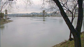
This video segment, adapted from Where the River Bends, a KET documentary, shows how climate change and glacier movement during the Ice Ages caused the now-vanished Teays River to move to the south and become the Deep Stage Ohio River. Listen to a local historian describe how the advance and retreat of the Wisconsin Glacier about 100,000 years ago caused the path of the Deep Stage Ohio River to change, creating the course of the modern Ohio River that impacted the growth and development of the region.
The modern Ohio River begins in western Pennsylvania and ends as a tributary to the Mississippi River near Cairo, Illinois. Between these two endpoints, the Ohio River defines the irregular state borders of eastern and southern Ohio, and northern and western Kentucky. However, the river did not always follow this path.
Before states were formed, even before human occupation of the Ohio Basin, the river flowed much farther north. To distinguish between the old and new river beds, the river’s older, northern route is known as the Teays River and its newer, southern route, the Ohio River. Changes in a river’s path occur naturally either through erosion that cuts new channels for the water to follow, or through damming that raises the water level until water overflows at a point before the dam and follows a new path. This latter process caused the Teays River to become the Ohio River.
The damming of the Teays began approximately 300,000 years ago when a glacier of the Pleistocene Ice Age advanced southward against the northward flow of the river. The great wall of ice blocked the river’s path, but water kept flowing from the south toward that wall, causing a lake to pool at the foot of the glacier. When the lake level rose high enough, water overflowed at some point and began a new route for the river. During the history of the Ohio River, the cycle of damming and overflowing occurred repeatedly as the glaciers pressed south, and eventually formed what is now called the Deep Stage Ohio River. The process was repeated all over again as subsequent glaciers covered the region, most notably the Wisconsin Glacier, which gradually changed the river’s path about 100,000 years ago to what we see today.
People were not there to observe the older Teays River or the advancing glaciers, so how do we know any of it happened? As with all geological history questions, scientists look for clues recorded in Earth’s crust. Some clues are revealed when people drill water wells or when hills are cut to build roads. As layers of rock and sediment become visible, each layer exhibits different characteristics. Tracing the layers across the landscape allows geologists to reconstruct the history of deposition and erosion in a region. Geologists can reconstruct past landscapes over long distances by drilling additional holes with a hollow steel tube that removes long columns of rock, called core samples.
Where the Teays River ran in Ohio, core samples contain thick deposits of glacial till. Glacial till is composed of unsorted sediments that were picked up and carried by a glacier and deposited when it melted. Beneath the glacial till are layers of other rock deposits showing varying degrees of erosion, and the erosion patterns indicate an ancient riverbed. This buried riverbed can be traced upstream to where it joins the current Ohio River near Portsmouth, Ohio. It can also be traced downstream to the Saint Louis area where the current Mississippi River joins and follows the ancient Teays River route. Through such clues buried in the earth, geologists are able to reconstruct the past history of the Ohio River, and the role that glaciers had in determining the ultimate course of the river.
 Loading Standards