Teachers' Domain - Digital Media for the Classroom and Professional Development
User: Preview

Source: NatureScene: “Mount Rainier”
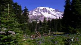
In this video segment from NatureScene, host Jim Welch and naturalist Rudy Mancke explore the Nisqually glacier on Mount Rainier. Listen as Rudy discusses glacier formation and the Nisqually River which starts at the base of the glacier. Also, see an example of a terminal moraine.
Towering 14,410 feet above sea level, Mount Rainier originated in the Quaternary Period, about 2.9 million years ago. Mount Rainier has a cover of snow and ice equal in volume to that of all of the snow and ice covering the other Cascade Range volcanoes combined. The Nisqually Glacier is one of the larger glaciers on the southern face of Mount Rainier.
Glaciers like Nisqually are sensitive indicators of climate changes. Climatic conditions regulate the size of a glacier because they control the quantities of snowfall and melt. The position of the snout, or terminus, of a glacier may change as the relative quantities of snowfall and glacier melt change. If summer melt exceeds winter snowfall, the terminus retreats, whereas if snowfall exceeds summer melt, the terminus advances. Changes in terminus position do not occur all at once, but typically take several years to become apparent.
The position of the snout of the Nisqually glacier was first recorded in 1857, and sporadically thereafter until the end of the century. Continuous recordings of its frontal position were made after the Mount Rainier became a National Park in 1899. Together with geologic dating of moraines that record past glacier-margin positions, observational records provide a detailed picture of the variations of Nisqually and of the climatic trends which controlled its fluctuations.
The "Little Ice Age" which lasted from the 15th to the 19th century, was a cold period with advances of mountain glaciers on several continents. This cold period resulted in crop failures and famines. Between the height of the Little Ice Age and 1950, Mount Rainier's glaciers lost about one-quarter of their length. Mount Rainier’s glaciers advanced during the late 1970's and early 1980's as a result of high snowfalls during the 1960's and 1970's. Since the early-1980's through 1992, many have been thinning and retreating. Some advances have slowed in response to drier conditions that have prevailed since 1977.
Since 2001, glaciologists have taken measurements at defined points on the glacier surface, using stakes and optical survey techniques to monitor the effects of global warming. Each point's altitude is compared over time and changes are noted for each stake. The glacier is divided into sections based on elevation, and averages are taken of any measurements in that band. These measurements form the basis for describing the state of the glacier.
Approximately 70 percent of Earth’s fresh water is contained in glaciers. As global warming reduces ice volumes, causing glaciers to melt faster than they can be replenished by snowfall, serious water shortages are predicted for areas fed by glaciers such as the communities served by the Nisqually River.
To learn more about the Nisqually Glacier at Mount Rainier, check out Glaciers, Fastest Glacier or Documenting Glacial Change.
 Loading Standards