Source: NASA/Goddard Space Flight Center
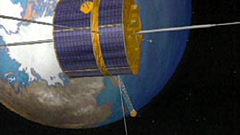
While the Moon is Earth's only natural satellite, there are thousands of artificial satellites circling our planet for navigation, communications, entertainment, and science. These satellites are an integral part of our everyday life, and they provide a source for scientific data unavailable from Earth's surface. This video segment adapted from NASA's Goddard Space Flight Center describes some of the different kinds of satellites that orbit Earth.
 Download, Share, and Remix
From their vantage points far above Earth's surface, satellites offer views of both outer space and our planet. Satellites located above the atmosphere can provide clearer and more detailed views of the universe than ground telescopes can; they are free from the distortion and absorption effects caused by Earth's atmosphere. The view of Earth itself from orbit also allows for observations that could not be taken from the ground. Earth-observing satellites can provide continuous views of the planet and gather data daily over the entire globe.
Sensors and other instruments onboard satellites gather data about Earth by detecting electromagnetic radiation — most commonly in the visible and infrared ranges. Visible light images show the amount of sunlight that is reflected from objects and can be used to study clouds, aerosols, and Earth's surface. Infrared radiation is invisible, but with the help of computers, infrared light is very valuable in studying many processes on Earth. For example, infrared data gathered by satellites can identify temperature differences in ocean currents, as well as reveal cloud structures and movements. Infrared radiation can also be used to examine the thickness of ice in the polar regions and to help explain volcanic eruptions. In addition, infrared radiation is used to measure vegetation cover and determine the composition of soils, rocks, and gases.
Microwaves — high-energy radio waves — can study the Earth system in two different ways. Passive microwaves are measured similarly to infrared radiation — objects emit and reflect microwaves and the data is used to study sea surface temperature, atmosphere, soil moisture, sea ice, ocean currents, and pollutants. Microwaves have an advantage over infrared wavelengths because they are less affected by water vapor, aerosols, and clouds, and therefore they can be measured in a wider range of conditions. Active microwave sensing uses the radar technique, in which the satellite releases pulses of microwaves towards Earth's surface and then detects the reflected radiation. This radar method allows for distance measurements such as wave height, topography, and glacier flow.
 Loading Standards


 Print Background Essay