Teachers' Domain - Digital Media for the Classroom and Professional Development
User: Preview

Source: National Park Service
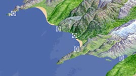
Tides, currents, shelf slope, and geologic history all influence how coastline features are broken down or built up. However, more than any other factors, wave energy and coastal rock type influence the erosional processes that shape rocky coastlines. In this interactive resource adapted from the National Park Service, learn about sea stacks, fjords, and other features that characterize rocky coasts in some of America's national parks.
Coastlines, the areas where land and bodies of water meet, are generally one of two basic types: rocky coasts and sandy coasts. Rocky coastlines, which are shaped by erosion, are typically located on active or once active margins where continental and oceanic plates converge or slide past one another. These margins are characterized by a narrow continental shelf that pitches sharply from land to sea.
Rocky coastlines take on either a steep or a gradual profile depending on the type of rock being eroded and the amount of wave energy acting on it. For example, resistant rock such as granite, combined with high-energy wind and wave activity, will display a steep profile — eroding uniformly, but very slowly. By contrast, where shale and other more easily eroded rock types are subjected to low-energy winds and waves, a more gradual slope forms from land to sea.
Rocky headlands are projections of land that form when certain types of rock in a cliff erode more slowly than others. Where this occurs, characteristic landforms develop in a fairly predictable sequence over a long period of time. As waves are forced to bend around a headland and concentrate their energy on either side of its point, a tube-like passage called a sea cave begins to form at any weakness in the rock along the cliff base. Wave action gradually deepens and widens the cave, and if it wears completely through the headland, it forms an arch. When the roof of the arch itself collapses, it leaves a rock column called a sea stack. Until a sea stack collapses, it is the last visible remnant of an ancient coastline.
The long-term net effect of wave erosion is that jagged coastlines tend to smooth out. A nearly level platform beneath the water remains where a rocky cliff or headland has been worn back. This wave-cut platform or terrace offers some protection from further erosion by dissipating wave energy.
Australia's Shipwreck Coast in southwest Victoria features many dramatic rocky coastline features. The Twelve Apostles are a series of giant sea stacks along the Port Campbell cliffs. Beginning 20 million years ago, the Southern Ocean's relentless wave action began to wear back the limestone cliffs. Gradually, caves turned into arches, and when the arches collapsed, rock pillars up to 45 meters (148 feet) high were left isolated from the shore.
 Loading Standards
 Teachers' Domain is proud to be a Pathways portal to the National Science Digital Library.
