Teachers' Domain - Digital Media for the Classroom and Professional Development
User: Preview

Source: KUAC and Geophysical Institute of the University of Alaska, Fairbanks
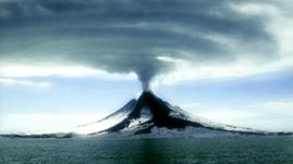
In this video adapted from KUAC-TV and the Geophysical Institute at the University of Alaska, Fairbanks, learn how thermal imaging is used to help predict volcanic eruptions. See how satellite sensors can measure ground temperatures over large areas using infrared radiation. Observe how another device, a forward-looking infrared radiometer (FLIR), provides higher resolution images, and understand how monitoring volcanoes can reduce risks for air traffic and local residents.
To the naked eye, it appears that Earth's crust is static, but in actuality the tectonic plates that make up Earth's crust have been moving in slow motion for millennia. As tectonic plates slide over, under, and alongside each other, stress is created and released, resulting in geologic events such as earthquakes and volcanoes—especially in the zones along plate boundaries. For instance, the plate boundaries that encircle the Pacific Basin are home to more than half of the world's active volcanoes. This arc, called the Pacific Ring of Fire, is the site of frequent earthquake and volcanic activity that is a direct result of moving tectonic plates. Most of the over 40 active volcanoes found in Alaska are located along the Aleutian arc where the Pacific plate subducts, or slips beneath, the North American plate.
There are a number of hazards associated with volcanoes. Lava flows, pyroclastic flows (hot mixtures of ash, rock, and gas), and lahars (a type of pyroclastic mudflow mixed with water) pose threats to nearby areas. Landslides, avalanches, and tsunamis generated by landslides are also potential dangers. In addition, ash plumes are difficult to distinguish from normal weather clouds and can cause serious damage to plane engines.
Researchers vigilantly monitor volcanoes to look for warnings of potential eruptions. Signs of volcanic unrest—such as increased seismic activity, changes in the shape and surface of the volcano, and gas emissions—can provide clues to an impending eruption up to months in advance. Thermal imaging, which is the creation of images based on temperature, is one of the most useful tools for monitoring volcanic activity (especially those in remote areas); researchers look for changes in the magma and gases within a volcano. The visible light that humans can see is just one small portion of the electromagnetic spectrum. Thermal imaging uses infrared radiation, which lies just below the red range of visible radiation, in terms of energy. Although humans cannot see infrared radiation, we can sense it as heat. In order to "see" temperature differences, researchers look at images provided by equipment that detects infrared radiation and displays temperature differences visually.
Weather satellites can also detect heat anomalies; for instance, as magma flows near the surface of a volcano, an image from a weather satellite may show a hot spot. Although the instruments onboard weather satellites do not have very high resolution (their resolution is about one square kilometer per pixel), they can be useful for initial detection. Instruments onboard other satellites, such as the Advanced Spaceborne Thermal Emission and Reflection Radiometer (ASTER) on the Terra satellite, can be tasked to do further research at higher resolution (ASTER has a resolution of 15–90 square meters per pixel.). In addition, a portable device called a forward-looking infrared radiometer (FLIR) can be used to provide high-resolution thermal images. A FLIR camera can gather data at very close ranges, such as from a helicopter hovering above a volcano.
 Loading Standards
 Teachers' Domain is proud to be a Pathways portal to the National Science Digital Library.
