Teachers' Domain - Digital Media for the Classroom and Professional Development
User: Preview

Source: Valdez Museum & Historical Archive
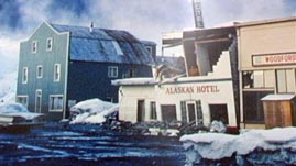
In this video adapted from the Valdez Museum & Historical Archive, learn about the Great Alaska Earthquake of 1964. Hear a first-person account of the event, watch an animation that illustrates the subduction of the Pacific plate under the North American plate, and observe how Valdez was affected. In particular, learn about how the earthquake liquefied the ground, generated tsunami waves, and forced the community to rebuild in a new location.
Earth's lithosphere is made up of many separate tectonic plates that slowly move and interact with one another. The movements of these plates are responsible for the formation of various geologic features and events, such as ocean basins, mountains, volcanoes, and earthquakes. Most earthquakes occur along faults, which are fractures or cracks in Earth's crust; while many of these faults are along plate boundaries, faults are also located in the interior of plates.
Faults are classified by how the ground on one side of the fault moves relative to the other side. For example, at a strike-slip fault, there is horizontal motion parallel to the fault: the two sides slide side-by-side in opposite directions. Alternatively, at normal or reverse faults, there is vertical displacement: one side moves upward or downward relative to the other side. At a normal fault, the two sides generally move apart from one another, which causes one side to slide down against the other side (the normal motion that would be expected due to gravity); divergent boundaries, where tectonic plates move away from each another, typically form normal faults. Conversely, at a reverse (or thrust) fault, the two sides are generally pushed together, which causes one side to be pushed up and over the other; convergent boundaries, where tectonic plates move toward each other, typically form reverse faults. Because the sides along a fault do not slide smoothly against one another, the motion strains and deforms the crust, building up stress that is eventually released as an earthquake.

In the United States, Alaska (which lies at the boundary between the North American and Pacific plates) is the most seismically active state—up to 4,000 earthquakes may be recorded in a single year. Off the southeastern shore of Alaska, the eastern edge of the Pacific plate and the western edge of the North American plate move roughly alongside each other as the Pacific plate slides north and west along the North American plate; there are a series of strike-slip faults, notably the Fairweather and Queen Charlotte faults, along this transform boundary. There are also active faults in the interior of Alaska. For example, the Denali fault is a major strike-slip fault that curves through the interior of Alaska and Canada.
However, the majority of earthquakes in Alaska occur along the Alaska-Aleutian Megathrust, the large fault zone where the North American plate is forced over the Pacific Plate. At this boundary (along southern Alaska, the Alaska Peninsula, and the Aleutian Islands), the Pacific plate subducts, or slides, beneath the North American plate at a rate of five to seven centimeters per year. The movement causes compression and strain on the North American plate, which is sooner or later released as an earthquake. The most powerful recorded earthquake in North American history—the Great Alaska Earthquake on March 27, 1964—occurred at this fault.
The 1964 earthquake violently shook the ground for several minutes, generated several tsunamis, and had devastating effects. In particular, many coastal communities were severely damaged and landscapes were significantly altered. For example, the town of Portage subsided nearly three meters (and remains partially submerged today) while other villages like it disappeared completely. Areas of the Copper River Delta were uplifted by about two meters, considerably changing the ecology of the region. Even in areas as far away as Oregon, there was significant damage caused by the tsunami.
 Loading Standards
 Teachers' Domain is proud to be a Pathways portal to the National Science Digital Library.
