Teachers' Domain - Digital Media for the Classroom and Professional Development
User: Preview

Source: University of Alaska
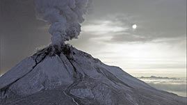
In this interactive activity adapted from the University of Alaska, learn about four of Alaska's active volcanoes: Augustine, Cleveland, Okmok, and Veniaminof. Explore each volcano through photographs and investigate how different types of satellite images (synthetic aperture radar, thermal infrared, and color composite) are used to study volcanoes. In addition, learn why it is important to be able to predict the movement of volcanic ash, and observe how a computer model called Puff simulates the movement of ash after an eruption.
Volcanoes are most often found along the boundaries where tectonic plates meet. One such zone, which encircles the Pacific Basin, is known as the Pacific Ring of Fire. Alaska, which is located at the boundary of the Pacific and North American plates, is home to more than 50 active volcanoes. Scientists study and vigilantly monitor Alaska's volcanoes because there are serious volcanic hazards that place both people and property at risk. Volcanic ash in the atmosphere endangers aircraft—it can quickly damage aircraft engines. Ash that falls to the ground can also cause health problems and interfere with telecommunication, transportation, water, and power systems. Other ground-based hazards include lava flows, pyroclastic flows (fast-moving mixtures of hot gases and rock fragments), and lahars (mixtures of water and rock fragments): each has the destructive power to destroy everything in their path.
Alaska Volcano Observatory (AVO), which monitors and studies Alaska's volcanoes, works to predict volcanic activity and mitigate volcanic hazards. A joint program of the United States Geological Survey, the Geophysical Institute of the University of Alaska Fairbanks, and the State of Alaska Division of Geological and Geophysical Surveys, AVO conducts scientific investigations, monitors volcanic activities, and assesses potential hazards (such as types of events and areas at risk). AVO provides up-to-date information to local, state, and federal officials, as well as the public, and serves as the principal point of contact for information about Alaska's volcanoes. The alert-notification system has four levels of status for volcanic activity and hazards on the ground (Volcano Alert Level: Normal, Advisory, Watch, Warning) and in the air (Aviation Color Code: Green, Yellow, Orange, Red).
AVO uses a variety of tools—including seismometers (instruments that measure motions of the ground) and satellite images—to gather data about volcanoes. Months or weeks before an eruption, a volcano can show signs of unrest. For example, the movement of magma within a volcano can generate earthquakes and cause the surface to swell. Networks of seismometers installed at selected volcanoes provide continuous readings detailing seismic activity and are key components of the monitoring program. Initially, only the few volcanoes located near Alaska's most populated areas were monitored, but AVO has since expanded seismic monitoring to more than 20 volcanoes.
Data gathered by satellites provides further information. For example, synthetic aperture radar (SAR) satellites can show changes in the shape of a volcano, thermal infrared (TIR) images display temperature differences, and color composite images provide information about surface materials. AVO analyzes satellite data twice daily for thermal anomalies (areas of higher temperature than normal) and ash plumes. Other instruments and techniques, such as global positioning systems, are also used to monitor changes in the surfaces of volcanoes (such as swelling and deformation). Volcanoes outside the seismic network are monitored by satellite imagery; observations of airplane pilots may prompt investigations as well.
 Loading Standards
 Teachers' Domain is proud to be a Pathways portal to the National Science Digital Library.
