Teachers' Domain - Digital Media for the Classroom and Professional Development
User: Preview

Source: KUAC and Geophysical Institute of the University of Alaska, Fairbanks
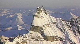
In this video adapted from KUAC-TV and the Geophysical Institute at the University of Alaska, Fairbanks, learn how mountains, volcanoes, and earthquakes in Alaska result from plate tectonics. Animations illustrate how the subduction of the Pacific plate under the North American plate and the collision of the Yakutat block builds mountains, such as the Wrangell and St. Elias Mountains. In addition, observe how technology (such as seismometers, satellites, and the Internet) helps scientists study the movement of Earth's crust, and learn about the surprising finding that there are still aftershocks being measured decades after the 1964 earthquake.
Geologic features such as ocean trenches, mountains, and volcanoes form as a result of the motion of tectonic plates. Earth's crust is composed of several major, and many minor, plates that slowly move and interact with one another as they ride on the hot, more fluid-like interior region of Earth. Alaska's high mountains, volcanoes, and earthquakes result from this plate movement, called plate tectonics. The state's location at the boundary between two major plates—the North American plate and Pacific plate—makes Alaska one of the most geologically active regions in the world.
The Pacific plate moves northwest relative to the North American plate at a rate of about five to seven centimeters per year. The Pacific plate is made of oceanic crust, which is denser than the continental crust of the North American plate. At the boundary along the northern edge of the Pacific plate, the Pacific plate subducts, or slides, under the North American plate. This subduction zone forms a deep ocean trench—the Aleutian Trench. As the subducting plate descends into Earth's hot interior, the heat causes melting of the overlying material, creating magma. The magma then rises and forms an arc of volcanoes along the boundary. This process is responsible for the formation of the volcanic mountains of the Aleutian Range and the Aleutian Islands.
Other mountains in Alaska, including the Wrangell, St. Elias, and Chugach ranges, were also formed by the action of plate tectonics. In particular, at the bend along the boundary between the Pacific and North American plates, there is a fragment of crust—called the Yakutat block—that is in the process of accreting, or attaching, to North America. This piece of crust, called a terrane, is a piece of another plate, with a different geological history, that has been moved by tectonics. The collision of the plates has built the mountain ranges over millions of years and, even now, continues to push them higher.
The processes of subduction and collision of tectonic plates causes earthquakes. When tectonic plates do not slide smoothly against one another, stress builds along fault lines; the strain on the rock on either side is released in a sudden movement that sends waves of energy traveling through Earth. Earthquakes are common along plate boundaries, and the subduction zone along Alaska is no exception. In fact, one of the most powerful earthquakes in recorded history occurred there in 1964. Decades after the event, there are still aftershocks associated with this event as stress along the fault zone is released.
 Loading Standards
 Teachers' Domain is proud to be a Pathways portal to the National Science Digital Library.
