Teachers' Domain - Digital Media for the Classroom and Professional Development
User: Preview


Source: Pathways to Technology: "Precision Agricultural Intro"
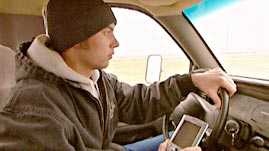
In this video adapted from Pathways to Technology, you’ll learn how geographic information systems (GIS) and global positioning systems (GPS) are changing the ways professionals, in many fields, make decisions about their businesses. GPS/GIS technology is used in farming, emergency management, environmental resource work, and city planning. With GPS/GIS, any kind of flow that needs to be studied, from traffic to crop yields to pollutants, can be tracked, mapped, and analyzed.
Geographic information systems (GIS) and global positioning systems (GPS) provide detailed information about land and water, population density, traffic patterns, and other features of rural and urban environments. People who study GPS and GIS technologies can find career opportunities in a wide range of fields.
With GPS/GIS data, agricultural production can be improved, and farms can be managed better. Farmers can use this data to analyze water and soil, and to decide which crops will grow best on their land. They can also assess water purity and contamination levels, enhance nutritional impact, and determine pest control. The result: precision farming that boosts food production, manages pollutant runoff, and strengthens natural resources. Farmers around the world are beginning to adopt GPS/GIS technology to meet the food needs of the ever-growing world population.
GPS/GIS technology is also used in cities. Traffic patterns can be analyzed to help first responders, like firefighters and ambulance drivers, figure out the best route to an emergency. GPS/GIS can also track stress levels on bridges and overpasses, helping city planners determine when to repair or replace infrastructure. Cell phone manufacturers and carmakers offer GPS systems to help customers find destinations, travel the best routes, and avoid getting lost. There are new applications of GPS/GIS technology in dozens of industries every year, and new opportunities for those with GPS/GIS training.
 Loading Standards